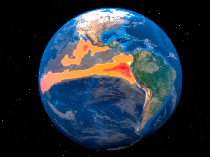
The world will almost certainly be affected by the natural El Niño phenomenon. Scientists at the United Nations expect that this phenomenon, in which the sea water temperature rises around the Pacific Ocean, will lead to record extreme temperatures and weather conditions around the world. The World Meteorological Organization (WMO) now declares that “all conditions are already in place” for an El Niño.
According to the World Meteorological Organization, the chance is now “90 percent” for the weather phenomenon to occur between July and September, and it is likely to continue thereafter. Over the past three years, the Pacific Ocean has already cooled due to La Niña, an analogue of El Niño. In March, meteorologists had already concluded that that period was clearly over and ocean warming was imminent. The last El Niño event was in 2018-2019.
Temperature records, heavy rainfall, severe drought
The ocean has actually warmed sharply in recent months compared to the average temperature. In addition to warming worldwide, El Niño can also cause heavy rains and floods in South America and the United States, and severe droughts in Australia and Southeast Asia. Europe is relatively unaffected by the natural phenomenon.
“You get a kind of snowball effect because of the warming of the Pacific Ocean,” explains science expert Martyn Peters. “And the greater the difference in surface water temperature, the greater the global impact.” That effect could be really big: “People are already expecting that we’re going to set a lot of new temperature records,” Peters says. He notes that this was also the case in previous years, but then during the La Niña period. “People now expect more heat and even more temperature records.”
differences
Why would there be such large impacts, for example, in Australia (heat and drought) and in the United States (cold and rain) and not in Europe? “We’re a long way from the Pacific,” Peters explains. As a result, the influence of El Niño will be less noticeable here. In Belgium, for example, we might expect a somewhat wetter spring. In general, we won’t notice much El Niño here, but we will see clear consequences all over the world.”
WMO assumes that the intensity of the phenomenon will be “at least moderate” and will continue to be felt throughout the year. However, the effect will become particularly evident in the coming year.

warning
WMO also believes that there is a 66 percent chance that the average annual global temperature in the next five years will be 1.5 degrees higher than it was before the industrial age.
“This does not mean that we exceed the 1.5 degree target of the Paris climate agreement, because this agreement is about long-term warming that lasts for several years. But it is a wake-up call and a warning that we are not heading in the right direction yet.”
In May, the World Meteorological Organization (WMO) warned that 2023-2027 will almost certainly be the warmest period on record due to the combined effect of El Niño and global warming from greenhouse gas emissions.
El Niño is officially back, with possible heat records as a result: what exactly is this weather phenomenon? And what can we expect in our country? (+)
‘What is happening now is unreal’: Scientists have been stunned by an unprecedented heatwave in the North Atlantic
See also. Scientists have been stunned by an unprecedented heat wave in the North Atlantic
Unlimited free access to Showbytes? Which can!
Log in or create an account and never miss a thing from the stars.

“Creator. Award-winning problem solver. Music evangelist. Incurable introvert.”


More Stories
British military spy satellite launched – Business AM
Alarming decline in the Caspian Sea
Lithuania begins construction of military base for German forces